Welcome to Part 1 of our three-part series on Navigating Chicago. This series is intended mostly for people new to the city or tourists who really want to know their way around.

In Part 1 (this post), we’re going to cover Chicago’s grid system, including the major streets and how to navigate from point A to point B.
In Part 2, we cover the streets downtown. Not every street, but rather the major streets and some things to know, like how to navigate multi-level streets.
Chicago’s Grid System – Introduction
There’s little I love more about Chicago than its grid system of streets. I remember taking the bus to school as a kid (the public bus, not the school bus) and listening as the stops were called out one by one, always trying to remember their order. Now, I can run off the names of all the major cross streets in the city.
Okay, so maybe I’m a little more knowledgable about the North Side than the South Side. And I don’t know my diagonals super well. But that’s not the point…
What Is a Grid System?
A grid system of streets is where streets are laid out to look like a grid, with two sets of streets that run parallel to their own set and perpendicular to the other set.
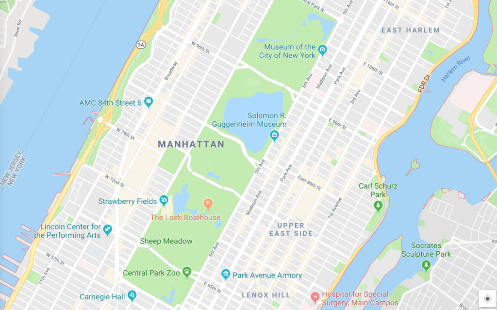
One famous example of a grid system is Manhattan in New York City, where avenues run perpendicular to streets:
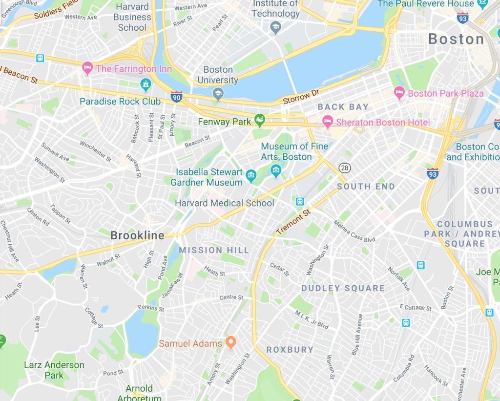
People who have spent most of their lives in cities with grid plans might be surprised to learn they aren’t ubiquitous. Here is Boston, for example:
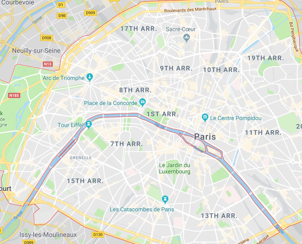
And Paris:
Chicago isn’t a perfect grid plan. There’s the shape of the shoreline, the Chicago River, multiple interstates, and a variety of train lines to contend with. But the system does have many virtues.
How does Chicago’s grid system work?
Chicago is oriented along the cardinal directions. That is, most streets run north/south or east/west. Contrast this with Manhattan, for example, which has a grid system that is angled 29 degrees.
Moreover, most of Chicago’s streets are numbered by how far north, south, east, or west they sit. Streets that run north and south are numbered with east or west addresses (e.g. Ashland is 1600 West). Streets that run east and west are numbered with north or south addresses (e.g. Division is 1200 North).
There are several diagonal streets, and they’re incredibly useful for getting through the city, but we’re not going to talk about them in depth here.
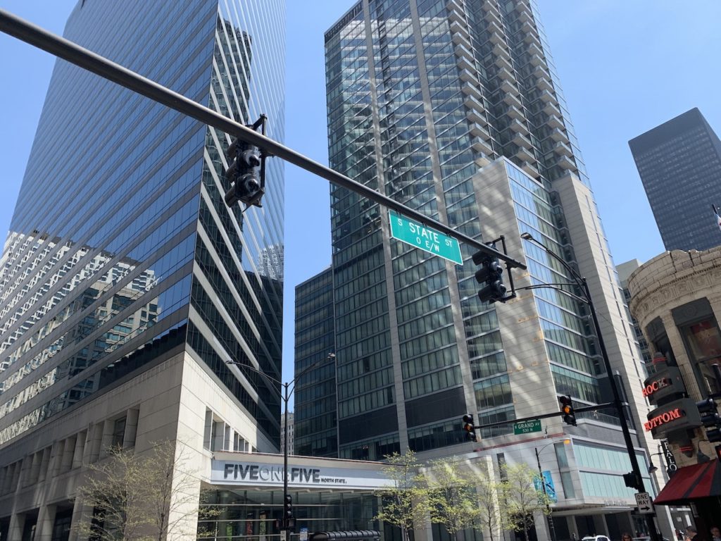
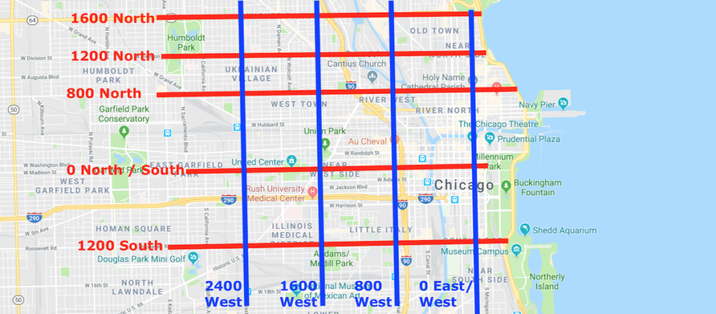
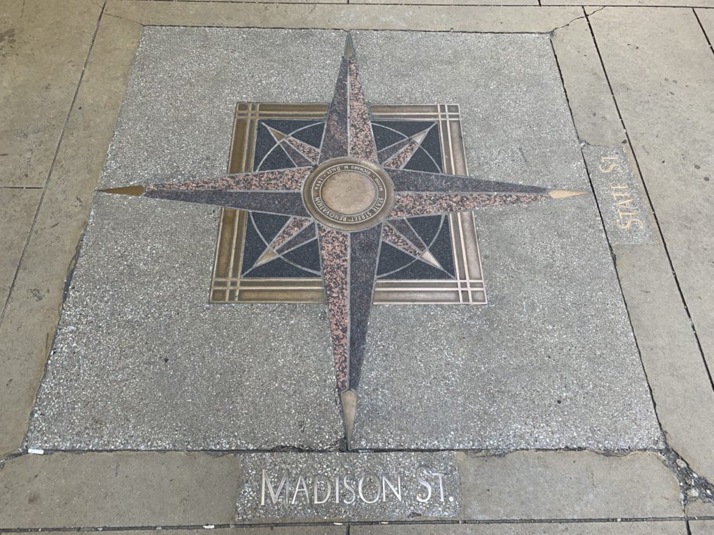
The numeric center of this system is State and Madison. State Street runs north and south, and has the address of 0 East / West. Madison runs east and west and has the address of 0 North / South.
From that intersection, the most major streets are numbered in 800 increments, with 8 city clocks covering a mile (and 5 city blocks covering a kilometer).
In between those major streets are the 400 increments, which are also usually significant streets.
For example, at 800 North, you’ll find Chicago Avenue, which runs parallel to Madison a mile north. At 800 West, you’ll find Halsted, which runs parallel to State a mile west.
To get from State and Madison (0 North / South and 0 East / West) to Chicago and Halsted, you’ll walk one mile north to Chicago and State and then one mile west to Chicago and Halsted.
Streets aren’t necessarily full city blocks apart. Randolph, for example, is at 150 North.
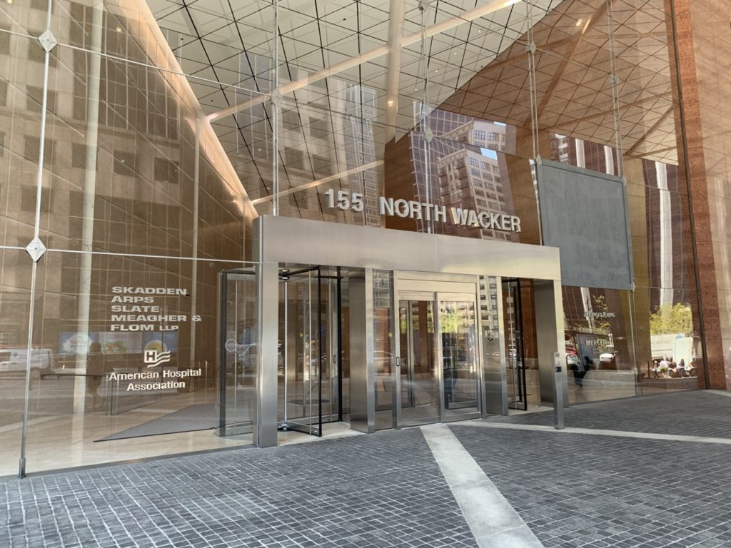
Buildings on these streets will have addresses that correspond to this system. So if you were looking for 155 North Wacker Street, you would look just north of Wacker and Randolph.
Getting from A to B in Chicago
The upshot of this is that you can easily calculate the distance and route between two addresses, at least if you have a little help or background knowledge.
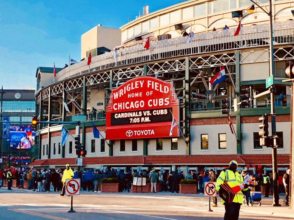
Let’s say you want to get from 1060 West Addison Street…
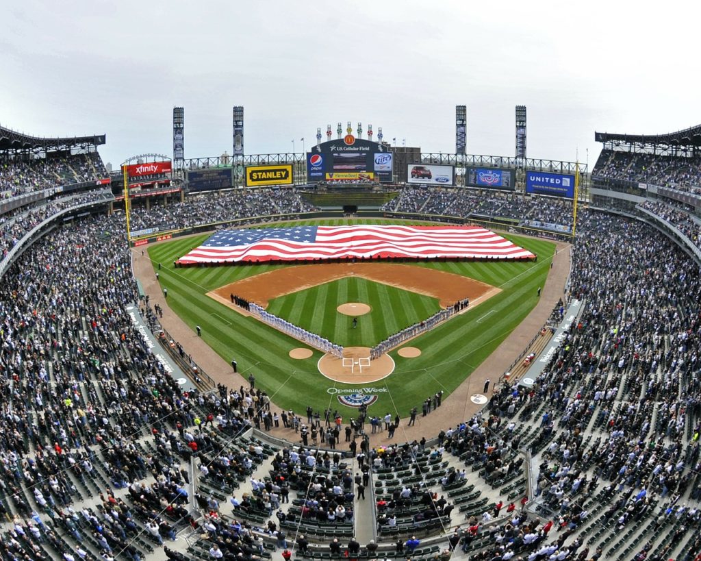
to 333 West 35th Street.
Here’s what you know right off the bat (pun intended):
- You’re at 1060 West
- You need to go east less than a mile to 333 West
- You need to get to 3500 South
Okay, so I gave you that last one. But now you know that most of Chicago’s South Side east/west streets are numbered so that, e.g. 35th Street is 3500 South.
Without further research or knowledge, you don’t immediately know that Addison Street is 3600 North.
But once you have that (it’s posted at every major intersection), you can easily compile directions–head south 71 blocks (just under 9 miles) and east 7 blocks.
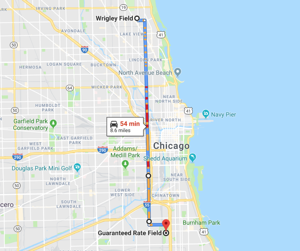
Okay so in this example you’ll might wind up taking the highway (but really should take Red Line train), but you get the point.
Chicago’s Three Sides
Finally, if you’ve done your reading on Chicago, you’ll notice it’s common to divide the city into the North Side, West Side, and South Side. You can easily guess that the “North Side” might start north of Madison and the South Side south of Madison.
But this isn’t really a hard and fast dividing line. Here’s an example of how some people might break down the city (again, this is a heavily disputed issue) with Madison and State as dotted lines:
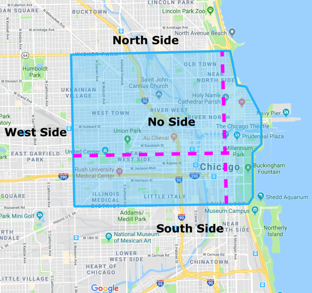
The blue area contains “downtown” and “near downtown” neighborhoods that usually aren’t really claimed by any “side.”
Most people don’t consider the South Side to start until Roosevelt Road at 1200 South (1.5 miles south of Madison), which is what we went with in the above map.
That said, Roosevelt is more the upper bound. Many people consider the South Side to start even farther south, with Cermak and 26th Street being popular alternatives.
Major (and some Minor) Streets of Chicago
We’re going to close with a list of the major streets in Chicago, with a few minor ones thrown in. This is all for reference and easily found on any map of the city, so feel free to move onto Part 2 of the series if you’d like.
Major Streets that Run North and South
We’re going to cover these from east to west. You could double this list by adding in streets at every 400 block, but we didn’t want to go overboard.
Technically the westernmost point of Chicago is O’Hare airport, the edge being a full 16 miles west of State Street. We’re going to start with Harlem, only 9 miles west of State Street.
- 7200 West – Harlem Avenue
- 6400 West – Narragansett Avenue / Nagle Avenue (Far North)
- 5600 West – Central Avenue
- 4800 West – Cicero Avenue
- 4000 West – Pulaski Road
- 3200 West – Kedzie Avenue
- 2400 West – Western Avenue
- 1600 West – Ashland Avenue
- 800 West – Halsted Street
- 0 East / West – State Street
- 100 East – Michigan Avenue (Magnificent Mile portion is about 150 East)
- 800 East – Cottage Grove Avenue (South Only)
- 1600 East – Stony Island Avenue (Far South Only)
- 2400 East – Yates Boulevard (Far South Only)
The easternmost point is the Illinois / Indiana border, about 5 miles east of State Street.
Major Streets that Run East and West (North Side)
Running north to south, things are a little less fixed. We’ve added in some additional blocks between the 800s to indicate additional major streets.
The most northern point is actually just north of Howard, but that street is the northernmost major street, 9.5 miles north of Madison.
- 7600 North – Howard
- 7200 North – Touhy Avenue
- 6400 North – Devon Avenue
- 6000 North – Peterson Avenue
- 5600 North – Bryn Mawr Avenue
- 5200 North – Foster Avenue
- 4800 North – Lawrence Avenue
- 4000 North – Irving Park Road
- 3200 North – Belmont Avenue
- 2400 North – Fullerton Avenue
- 1600 North – North Avenue
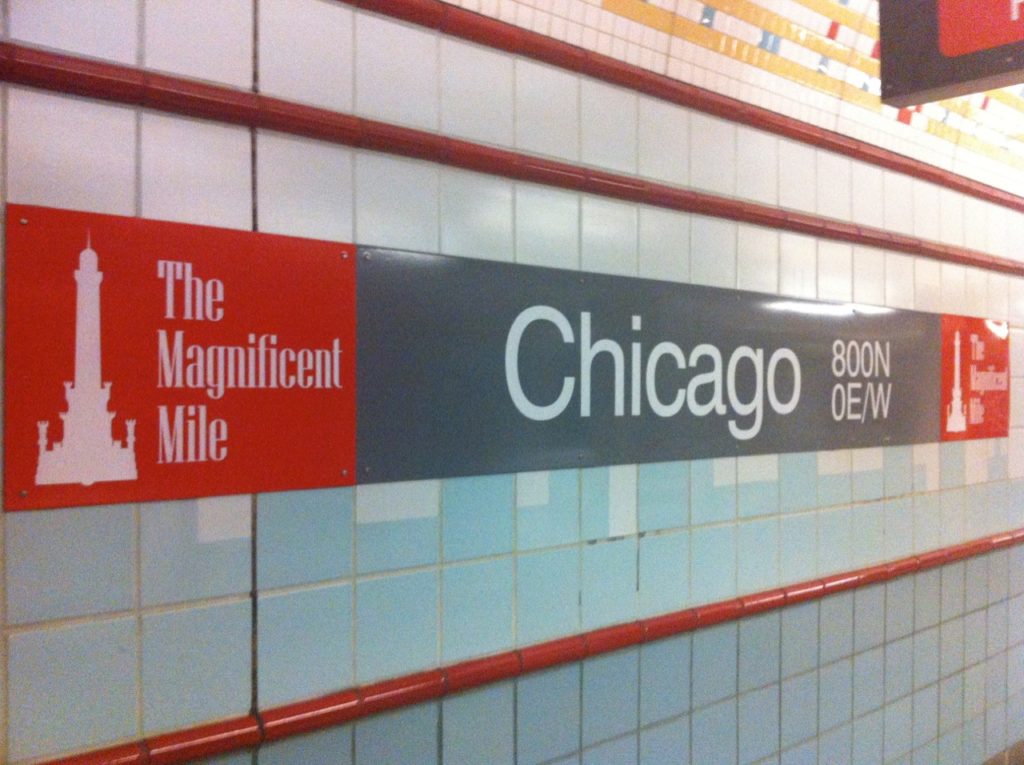
- 800 North – Chicago Avenue
- 0 North / South – Madison Street
Major Streets that Run East and West (South Side)
With more industry and railways, the geography of the South Side is a little more complex. You’ll see the major streets shift one block south at one point, and this is because 30th Street is a minor street but 31st Street is a major street.
Most of the east/west streets on the South Side are numbered according to their street address (e.g. 31st Street is 3100 South), which makes memorizing the streets relatively easy.
- 0 North / South – Madison Street
- 1200 South – Roosevelt Road
- 2200 South – Cermak Road
- 2600 South – 26th Street
- 3500 South – 35th Street
- 3900 South – Pershing Road
- 4700 South – 47th Street
- 5500 South – 55th Street / Garfield Boulevard
- 6300 South – 63rd Street
- 6700 South – 67th Street / Marquette Road
- 7100 South – 71st Street
- 7900 South – 79th Street
- 8700 South – 87th Street
- 9500 South – 95th Street
South of 95th Street, a variety of obstructions break down the ordinary flow of the streets.
Roughly, you can continue with numbered streets: 103rd, 111th, 119th, 127th. The southernmost edge of the city is 138th Street, 17.25 miles south of Madison.
This is the end of Part 1 of our “Navigating Chicago” series. Part 2 provides some information about the streets of downtown Chicago. Part 3 (coming soon) covers Chicago’s famous named highway system.