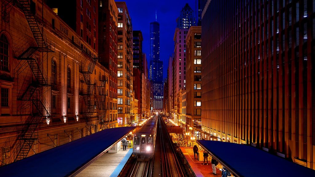
Chicago’s L train system is one of the largest and busiest train systems in the country. The L provides access to almost all of the city, and virtually no Chicagoan who has ever left the house hasn’t ridden the L.
In this guide, we hope to cover everything you need to know to successfully ride the L. This post is written mostly for tourists and Chicago newbies, but we have no doubt some locals could use a refresher.
This post is, to the best of our knowledge, accurate as of the date of publication. The official source for information on Chicago’s L train system is the CTA, which has a website through this link.
Contents
- How Do I Take The L In Chicago? (The Short Answer)
- Riding The L — Terminology
- Basics of the L Train Lines
- Fares, Tickets, and Ventra
- Train Tracking
- Riding the Train
- The L Train Lines, In Detail
- Transfers
- Safety on the L
- I Want To Get To…
How Do I Take the L In Chicago?
Fine, we’ll give you the short version. But you’re going to ask questions, and we’re going to tell you to read the rest of this post.
First, figure out where you need to go and make sure you need to take the L. Use Google Maps. It should tell you to take the Red Line, Blue Line, Green Line, Brown Line, Orange Line, Pink Line, Purple Line, or Yellow Line. Other trains—like ME, BNSF, MC-W—aren’t L trains.
Second, have a bank card or at least $3 cash on you. You’ll need this to purchase your ticket.
Third, go to your train station and purchase your ticket from the ticket machine. Purchase a $3 ticket (one ride and two transfers), a one-day ticket, or a Ventra Card that you can load with whatever value you want. If you have a contactless bank card, or Apple Pay or Android Pay, you can skip this step.
Fourth, tap your ticket / card / device at the turnstile, and go through.

Fifth, make sure you know what direction you’re going. Google Maps is helpful for this, or you can look at the line’s map and get on the train that is going the required direction.
Finally, head up to the platform and get on the train. Exit at your desired stops. And you’ve ridden the L!
Now, how about the longer version?
Riding the L — Some Terminology
“L”? WTF? Yea, let’s talk about some terminology.
Why is Chicago’s train system called the L?
Chicago’s main train system is colloquially referred to as “the L.” It consists of eight train lines—Red, Blue, Green, Brown, Orange, Pink, Purple, and Yellow.
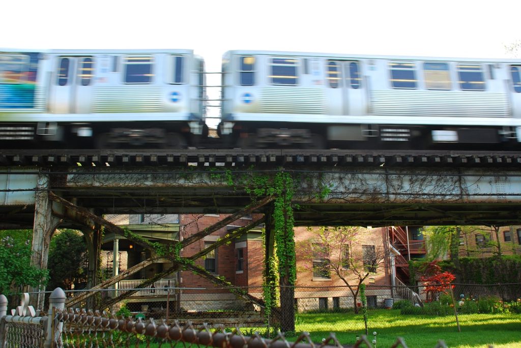
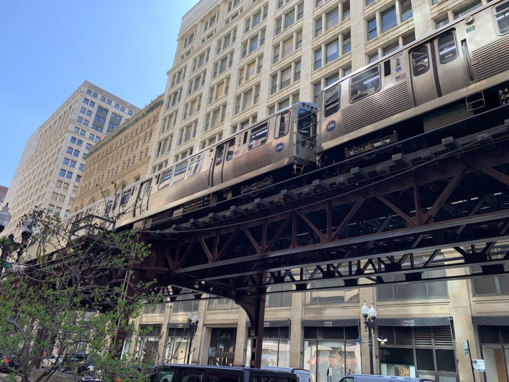
“L” is derived from “El” which is in turn an abbreviation for “elevated” which refers to the fact that much of the system is on elevated tracks that run above streets, rather than under them as in a traditional subway system.
“El” is also frequently used in place of “L”, including on several official city publications, but “L” is the official term used by the Chicago Transit Authority (CTA), which operates the trains and also operates the city’s bus system.
CTA and a second company, Pace, operate bus routes in the suburbs. Ventra is the payment system for riding the CTA (including buses and the L) and Pace buses.
Some L routes are at or above ground level for their entirety. Others spend a significant portion as subways. Regardless of whether you’re talking about a subway or elevated section, though, you can refer to “taking the L.”
By contrast, you would only say “taking the subway” if you’re going underground at some point. You can always say “train” and people will know what you mean. Well, sort of, more on that in a bit.
What is “The Loop”?
“The Loop” can refer to two things. First, the Loop is a neighborhood in downtown Chicago bound by the Chicago River (north), Lake Michigan (east), Roosevelt Road (south) and the Chicago River again (west). It is the center of business activity for the city and home to many tourist attractions.
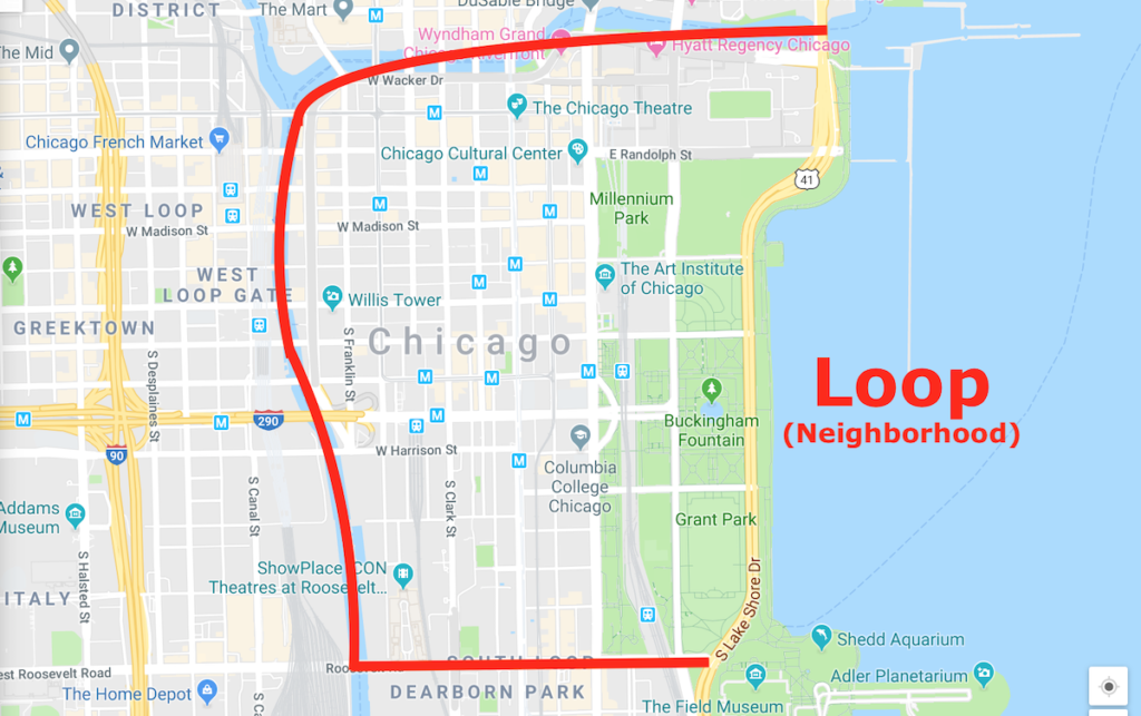
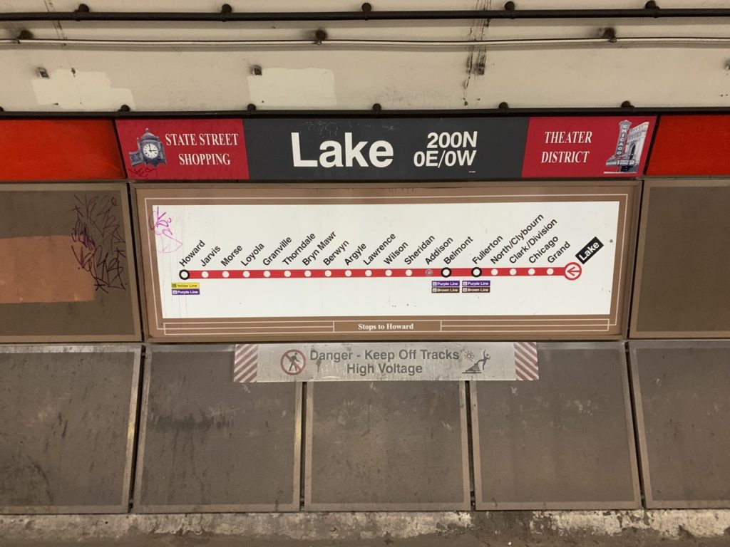
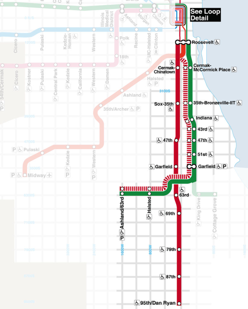
Second, the Loop is a section of elevated train tracks within the Loop (neighborhood). In particular, the Loop is a rectangular set of stops utilized by the Purple, Brown, Orange, and Pink Lines to service downtown and to turn the trains around.
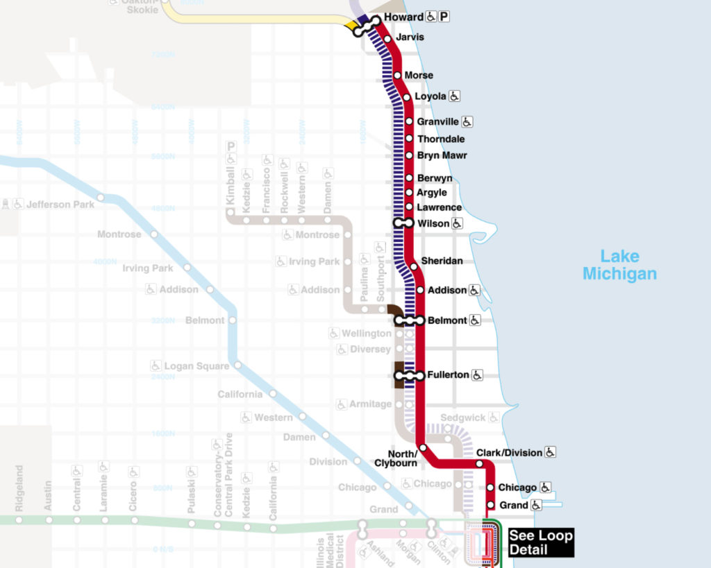
A fifth line — the Green Line — uses some of the Loop stops as it passes through downtown, but it doesn’t make the full loop and turn around like the other four lines. Here’s the maps of the L trains through downtown, with the Loop prominently featured:
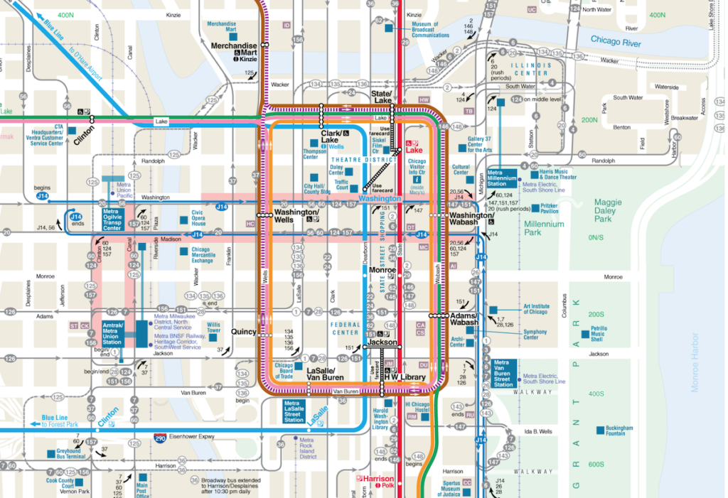
You can see that both the Blue Line and Red Line also pass through the Loop (neighborhood), but they don’t use the Loop (elevated train tracks). Large system maps usually have a separate inset just for the Loop because of the dense number of stops.
Chicago’s Other Trains
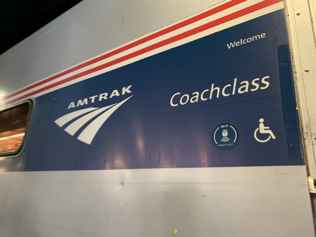
There are two train systems that operate in Chicago that are not the L. The first that most Americans are familiar with is Amtrak, the nationwide train system. Amtrak uses one stop in Chicago, Union Station. Amtrak has nothing to do with L or the other Chicago transportation infrastructure. You’ll need a separate ticket anytime you want to use Amtrak.
The other train system is Metra. Metra trains are “commuter trains.” That is, they’re designed to primarily serve people who live in the far reaches of the city or outside the city. They are generally nicer trains than the L trains, but they are more expensive, make fewer stops in the city, and run less frequently. Like Amtrak, Metra requires a separate ticket from the L.
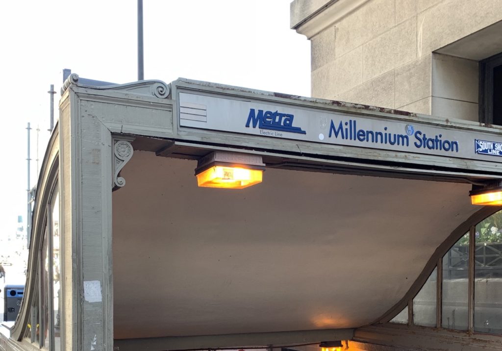
Metra trains terminate at one of four stations downtown–Union Station, Ogilvie Transportation Center, Millennium Station, and LaSalle Street Station.
If someone says “I’m taking the train to XYZ,” it’s reasonable to ask “Metra or CTA?” or “Metra or the L?” While most every destination in Chicago can easily be reached via some combination of CTA transit (the L and buses), it will sometimes be faster to take a Metra train.
Basics of L Train Lines and Directions
We’ll explain more about the individual lines below. First, we want to give a very basic overview of the essentials you need to navigate the L. (It might be helpful to read up on Chicago’s grid system as part of this background.)
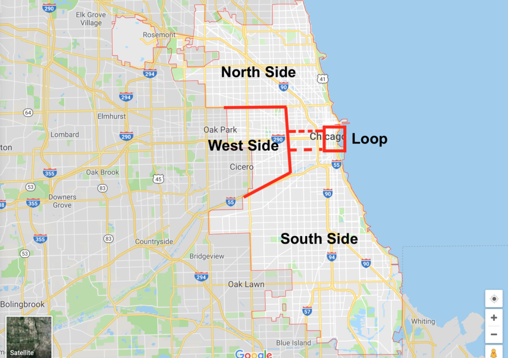
You can roughly divide Chicago into four sections: Downtown (the Loop), the North Side, the South Side, and the West Side.
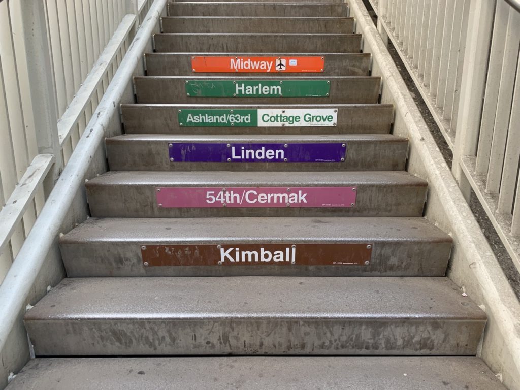
There are eight L train lines: Red Line, Blue Line, Green Line, Brown Line, Orange Line, Pink Line, Purple Line, Yellow Line. We’ll briefly describe where each of the lines goes, and we followup with a (not to scale) diagram for reference.
- The Red Line runs roughly straight north and south, connecting the North Side to the South Side and passing through the Loop in the middle (24 hours)
- The Blue Line runs from O’Hare airport in the far northwest corner of the city (on the North Side), through the Loop, and then west through the West Side (24 hours)
- The Green Line runs from the West Side through the Loop and into the South Side
- The Brown Line runs between the Loop and the northwest part of the city (on the North Side)
- The Pink Line runs between the Loop and the West Side
- The Orange Line runs between the Loop and Midway airport in the southwest
- The Purple Line is a complicated line, mostly it connects the city to the northern suburbs of Evanston and Wilmette
- The Yellow Line connects the northern end of the Red Line to the northwest suburb of Skokie

The L covers much of the city, but some neighborhoods popular to tourists and new residents aren’t directly on the L. For example, Streeterville residents are 10 to 15 minutes walking from the L. Hyde Park residents will have to rely more on the Metra or CTA bus system.
These trains run two ways, and whenever you are taking a train, you need to know the direction you need to go. If you’ve taken a city train before, this is probably obvious. But believe me, people ask regularly for help with this, and we’re happy to help.
By way of quick example, you are taking the Red Line from Fullerton to Jackson. If you pull up a system map (or look at one at the station) you’ll see that from Fullerton you need to go toward 95th Street to get to Jackson. So the train you need to get on is “the Red Line toward 95th Street.”
Google Maps is helpful for this, as its directions will indicate “TRAIN LINE Direction.” As we mentioned, several lines use the Loop to turn around. For those trains, the direction into downtown will just be indicated by “Loop.”
Trains sometimes use alternative endpoints. For example, you may see a Blue Line train heading the direction of O’Hare Airport that ends at (and is labeled) Rosemont instead.
Train directions are clearly indicated on the platform and via marquees on the trains themselves.
The CTA, in an attempt to be helpful, will make announcements on many platforms that go:
- “An OUTBOUND train, FROM THE LOOP, will be arriving shortly.”
- “An INBOUND train, TOWARD THE LOOP, will be arriving shortly.”
They make these announcements even on lines that don’t “end” in the Loop, which can be confusing, but they’re helpful to tourists who might only know whether they’re going toward the Loop or away from it.
We cover the train lines in more detail below, but for now we have some practical things to get out of the way.
Fares, Tickets, and Ventra
Now we want to talk about fares (how much the train costs) and how you can pay for your rides.
L Fares
The standard fare for a ride on the L is $2.50, but as we’ll see, if you’re relying on cash you’ll need at least $3 in order to ride the L. Discounted fares (not covered in this guide) are available for eligible customers. Rides from O’Hare International Airport cost $5. Transfers (covered more below) to other L lines, CTA buses, or Pace buses, cost 25 cents for two rides in two hours.
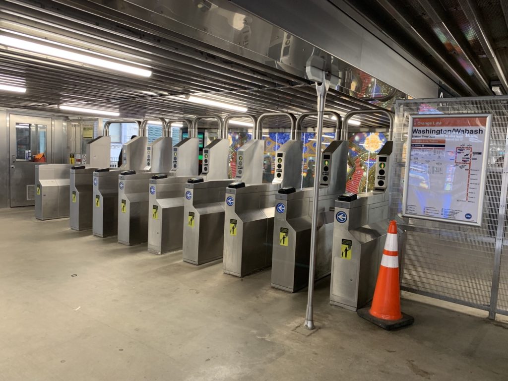
Chicago uses a single turnstile system with a fixed fare. You tap your card once to enter the station, are deducted the fare ($2.50) and that’s it. You don’t need to scan out.
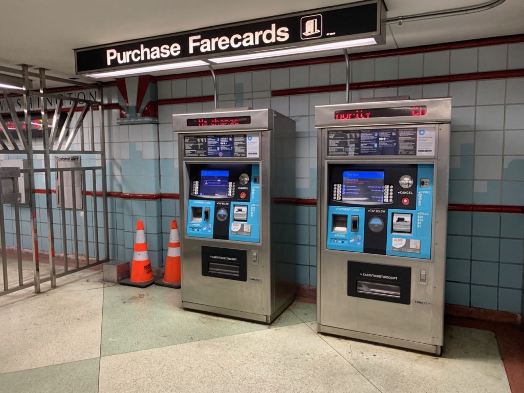
Buying Your Ticket / Pass
Chicago’s L trains, CTA Buses, and Pace (suburban) Buses are unified under the Ventra payment system. You can buy Ventra tickets and passes from Ventra machines located in every train station. They’re very intuitive to use.

There are a wide range of ticket / card options, and we’re going to try and cover the most important ones below.
Once you’ve purchased your ticket or pass, all payments to ride the L are made by tapping a physical card or ticket (covered next) on a Ventra Terminal.
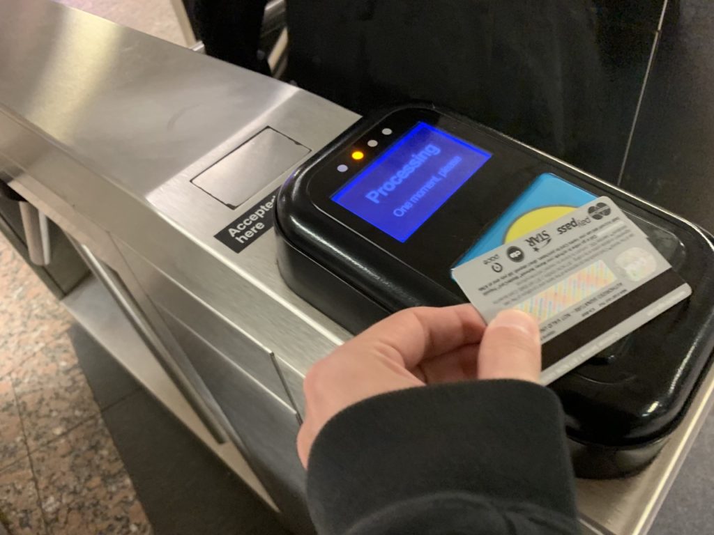
Taking the train, you tap, the terminal gives you a positive “ding” and visually indicates “Go,” and you walk through the turnstile. There are three ways to pay via Ventra.
Do L Trains Take Cash?
L trains do not take cash, but you can use cash at any station to buy a disposable ticket. The ticket will cost more than the standard $2.50 fare, as covered next!
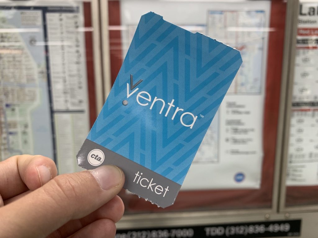
Disposable Ventra Tickets
One way to pay for an L ride is to use a disposable Ventra ticket. You can purchase two versions of this ticket. You can purchase a $3 version of the ticket, good for one ride and up to two transfers (the remaining balance is a fee). O’Hare sells $5 tickets that cover the fare from O’Hare (no transfers). Disposable tickets are not reloadable.
Another disposable ticket option is the 1-Day CTA Pass (unlimited rides on CTA buses and L trains, no Pace Buses) for $10. A 3-Day disposable ticket can also be purchased at O’Hare and Midway Airports for $20.
The disposable Ventra tickets can be purchased at any L station with cash or credit card.
Reloadable Ventra Cards
Another way to pay via Ventra is via a Ventra Card. A Ventra Card is a hard plastic card that you can reload with transit value or with a pass. A card costs $5, but that amount is credited to your account if you register the card. The passes are priced as follows:
- One Day — $10 (equivalent of four rides)
- Three Day — $20 (eight rides)
- Seven Day — $28 (11 rides)
- Seven Day with Pace Buses — $33 (13 rides)
- 30 Day With Pace Buses — $105 (42 rides)
You can register your Ventra Card to an online Ventra Account, which makes for convenient management of your passes and transit value. You can purchase, load, and reload a Ventra Card at any L station and most convenience stores.
Paying With Your Contactless Card or Device
The final way to pay via Ventra is to use your own contactless bank card. If you have a bank card that can be used to “tap to pay,” or if you have Apple Pay or Android Pay on your phone, you can use that.
The most straightforward way to use these is just to tap them and you will be billed the cost of the ride. As of April 2019, CTA and Ventra advertise that you can use personal cards for transfers, too (and you’ll be billed 25 cents, not the full ride cost).
The strangest option (in our mind) is to load your contactless card with a pass. I’ve never seen this or heard of it being done, but it is mentioned in a few spots on the CTA/Ventra websites as being a possibility.
Can I Use My Ventra Card For Metra Rides?
No, you can’t use your Ventra Card for Metra rides. However, you can purchase Metra Tickets through the Ventra app and use those for your Metra Ride. Also, there is the Metra Link Up pass a CTA / Pace pass for Metra commuters.
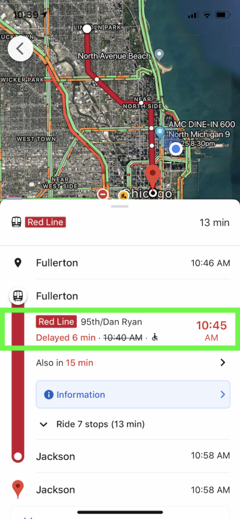
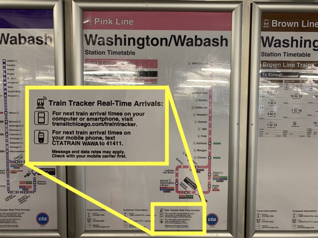
CTA L Train Tracking
There are a few different ways to track trains. Personally, I prefer Google Maps. Just click the train station. Depending on your settings, you’ll either go straight to the train listing or you’ll need to click “Subway Services” to see the times.
An alternative app is “Transit Stop.” I used to use this one, but I’ve never found it intuitive. You can also visit the CTA’s own train tracker website.
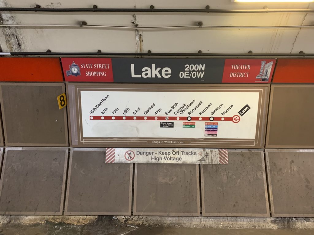
For a more old school method, you can get text alerts. I use this more for bus stops, but you can text “CTATRAIN [code]” to 41411 to get arrival times by text. The codes are available online and on the bottom of the route maps at the station:
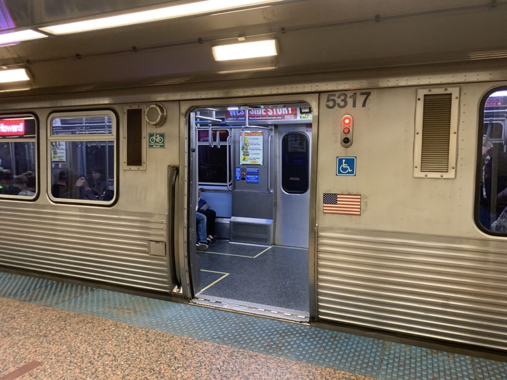
Riding the Train — Boarding to Exiting
There are basic protocols to be followed to ensure that everyone gets where they’re going in an efficient manner.
Trains in Chicago operate on the right side, like cars. Some stations use a single platform with two trains on opposite sides (make sure you board the right one). Some use two platforms with the two trains on the outside (make sure you go to the proper platform). And some serving multiple lines use two platforms, with two trains in between and two trains on the outside.
When waiting on your train, don’t stand on the blue at the edge of the platform. You’re not being cool or daring, you’re just ensuring that the approaching train has to travel very slowly, sending waves through the transit system that impact the commute of millions of people.
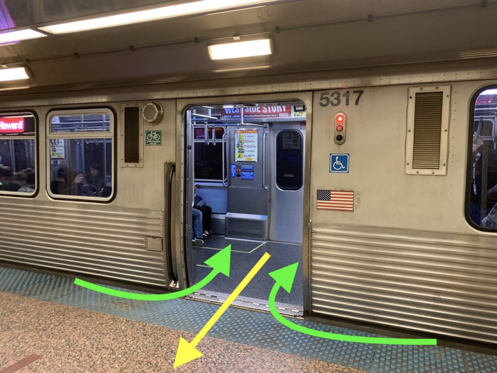
Allow people to exit the train first. While Chicago doesn’t have this posted, basic train etiquette is that people entering trains enter from the side of the doors and people exiting exit out the middle. This can be done simultaneously, but without a public notice it’s usually easiest just to let people exit first.
Once on the train, move as far away from the doors as reasonably possible given the length of your commute. If you’re standing, position your bag in front of you and face the people sitting. This effectively doubles the standing room in the aisles, as two average-sized people could stand back to back facing outward. It also keeps your bag safe.
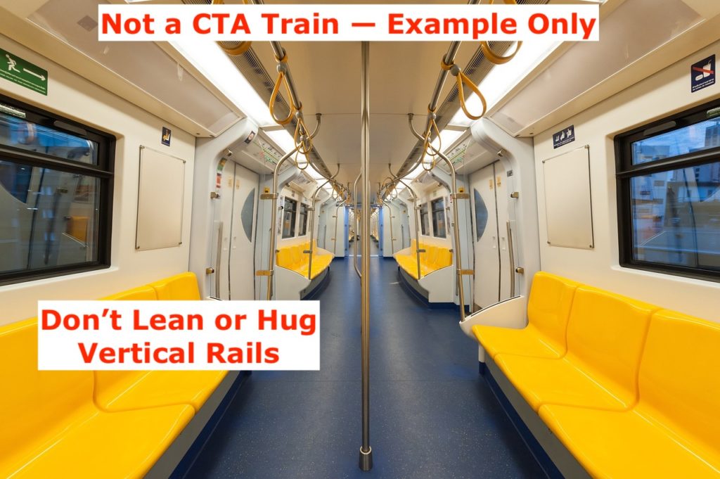
If you’re standing, use your hand to hold onto a rail. If holding onto a vertical rail, do so from a reasonable distance to allow other people to also hold onto it. Do not lean on or hug the vertical rails.
When exiting, you can politely say excuse me or just say loudly “comin’ out!” If you choose the latter, make sure you’re not doing it at a stop where everyone is exiting or you’ll look like a real toolbox. Either way, try to make your way toward the door before you actually get to your stop. Exit through the middle, allowing people to board from the sides.
Stations typically have multiple exits, so you’ll want to pay attention to what direction you need to go. They’re typically marked with cardinal directions or with street names.
The L Train Lines, In Detail
All of the L train lines are named after colors, and they’re referred to by those colors and those colors only.
This isn’t a complete guide to every individual line. Such a guide would be tantamount to a guide to the entire city, given the coverage area of Chicago’s trains. Rather, this section just seeks to give you a basic understanding of the lines while highlighting some key areas they visit.
Throughout, we’re going to mention landmarks and neighborhoods you might not be familiar with. Don’t stress about that because, again, the train lines cover pretty much the entire city, and no one knows the entire city.
Finally, some of the lines run into or through suburbs, and we identify them as such. While we’ll have a longer post about this one day, suburbs are not neighborhoods. Chicago is a large city comprising many neighborhoods, but these are all a part of the City of Chicago. A suburb, by contrast, is not a part of the city and has its own government.
The Red Line
The Red Line is the backbone of Chicago transit. It runs from the far north side’s Howard Station over 23 miles straight (mostly straight, really) south to the 95th Street Station.
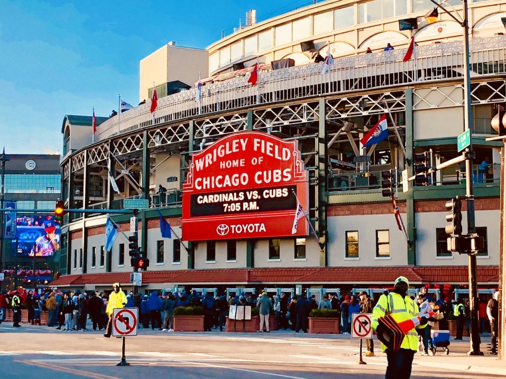
From the north into downtown, it passes by Loyola University, Edgewater and Uptown, Wrigley Field (home of the Chicago Cubs), Lincoln Park, River North (and the Magnificent Mile), before entering the Loop.
From the Loop south, it passes by Chinatown, Guarantee Rate Field (home of the Chicago White Sox), connections to Hyde Park / Museum of Science and Industry, and Chicago State University.
The Red Line is the go-to for moving north and south through the city. It isn’t a perfect line, but it roughly hugs the eastern edge of the city in the North Side and stays in the eastern portion once on the South Side.
From the Chicago stop to the Roosevelt stop, the train runs under State Street, and is thus sometimes referred to as “the State Street Subway,” though I’ve never heard a local use this term.
The Red Line also offers a rush period train that operates on the Red Line route from Howard to Roosevelt and then the Green Line route between Roosevelt and Ashland / 63rd. I don’t fully understand the purpose of this line. You can see it on the above map that shows the Red Line, Red Line Rush Service, and Green Line on the South Side.
The Red Line operates 24 hours a day, every day of the year.
The Blue Line
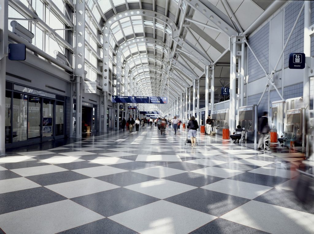
The Blue Line is the second most popular train line in the city. If you’re coming from out of town, this would be the line you’ll take from O’Hare International Airport into the city. The Blue Line operates 24 hours a day, every day of the year.
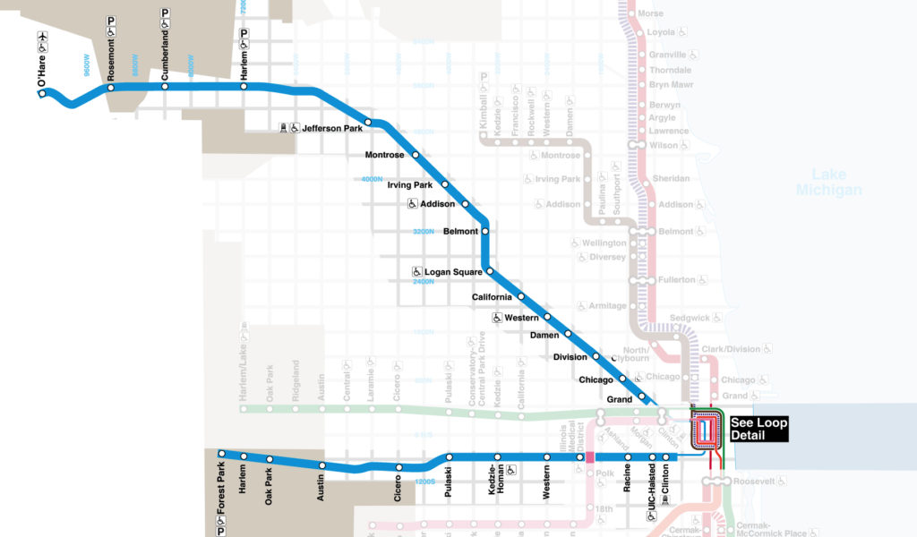
The Blue Line is the system’s longest line at nearly 27 miles. It comes in from O’Hare–the farthest northwest point in the city–travels southeast into the city, passing through Rosemont (a suburb), Jefferson Park, Logan Square, and Wicker Park along the way.
After a segment downtown, it heads straight west along Interstate 290, passing by UIC, the Illinois Medical District, and two suburbs—Oak Park and Forest Park—terminating in the latter.
Like the Red Line, the Blue Line operates as a subway for stretch downtown, and for the Washington, Monroe, and Jackson stops may be called “the Dearborn Street Subway,” though again, I’ve never heard a local say this.
One oddity of the Blue Line that riders must be aware of is that it has two stops named “Harlem” and two stops named “Western”. These are on opposite sides of the route, so you have to be sure to take note that you’re going to the correct Harlem or the correct Western.
The Green Line
The Green Line is an old friend of mine from my days living in Hyde Park (on the South Side) and working in Austin (on the West Side). At 20 miles long, the Green Line travels from Oak Park, a western suburb, straight east into the city, passing by Austin, Garfield Park and the Garfield Park Conservatory, the United Center, and Fulton Market on the way.
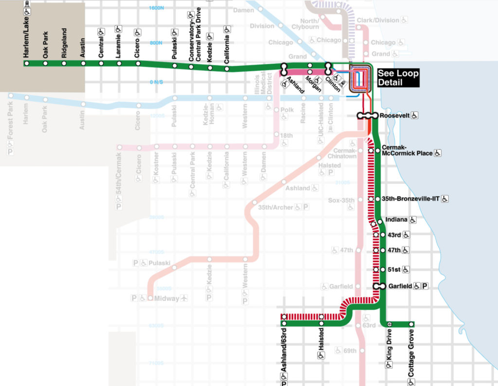
Arriving downtown, the Green Line makes a right turn along the Loop tracks before heading south, past McCormick Place, Illinois Institute of Technology, Bronzeville, and Washington Park. At 59th Street it forks. One branch heads east, ending just south of Hyde Park at Cottage Grove. The other heads west, ending in Englewood at Ashland and 63rd.
For its southern portion, the Green Line runs mostly parallel to the Red Line, just a bit east. It does not go as far south as the Red Line, though.

For its “northern” portion (that is, from the city to Oak Park), it runs parallel to the (southern portion of the) Blue Line, just a bit north. The most notable tourist attraction on this portion is the Garfield Park Conservatory.
Those three lines—the Red Line, the Blue Line, and the Green Line, are the three lines that visit significant chunks of the city. The remaining five lines are more niche, but definitely still worth knowing.
The Brown Line
Even though we covered the Green Line first because it spans so much of the city, the Brown Line is actually the third most popular in the city by passenger count. The Brown Line travels between the Loop and the northwest part of the city, filling the gap between the Red Line (straight north) and the Blue Line (northwest to O’Hare).
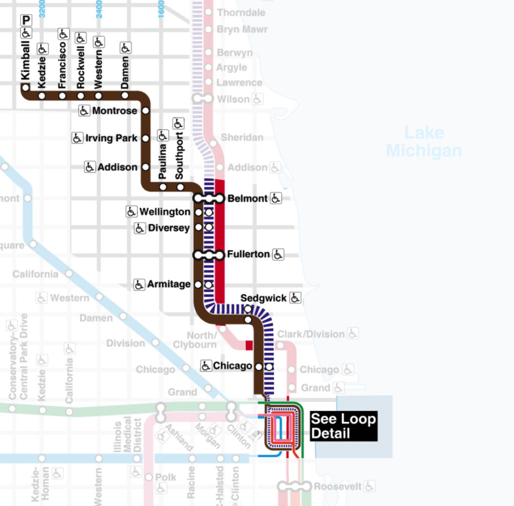
In particular, the Brown Line passes through Lincoln Park, Lakeview, Ravenswood, Lincoln Square, and Albany Park before terminating at Kimball and Lawrence.
The Brown Line is one of Chicago’s nicer routes, but it can be a long journey as the train has to twist and turn through the city on its elevated track.
The Pink Line
The Pink Line is another line that serves the West Side of the city, running parallel to and south of the Green and Blue Lines. While it’s Chicago’s newest line, and many Chicagoans probably don’t have a clue where it goes, this is low-key one of the best routes in the city.
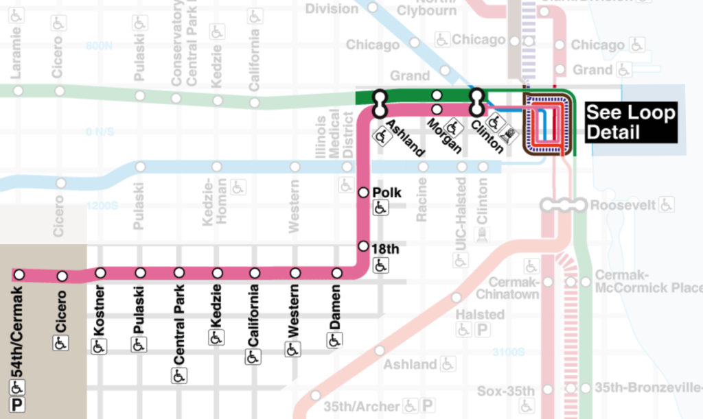
As it goes from Loop to 54th and Cermak, it will be filled with riders heading to the following list of interesting places: UIC, Greektown, Fulton Market, Illinois Medical District, Little Italy, Pilsen, Cook County Jail, Hawthorne Race Course, Chicago Motor Speedway, and Brookfield Zoo
The Orange Line
The Orange Line serves the southwest areas of the city that aren’t served by the Red and Green Lines (that run pretty much straight south from the Loop) and or the Blue, Pink, and Green Lines (that run pretty much straight west from the Loop).
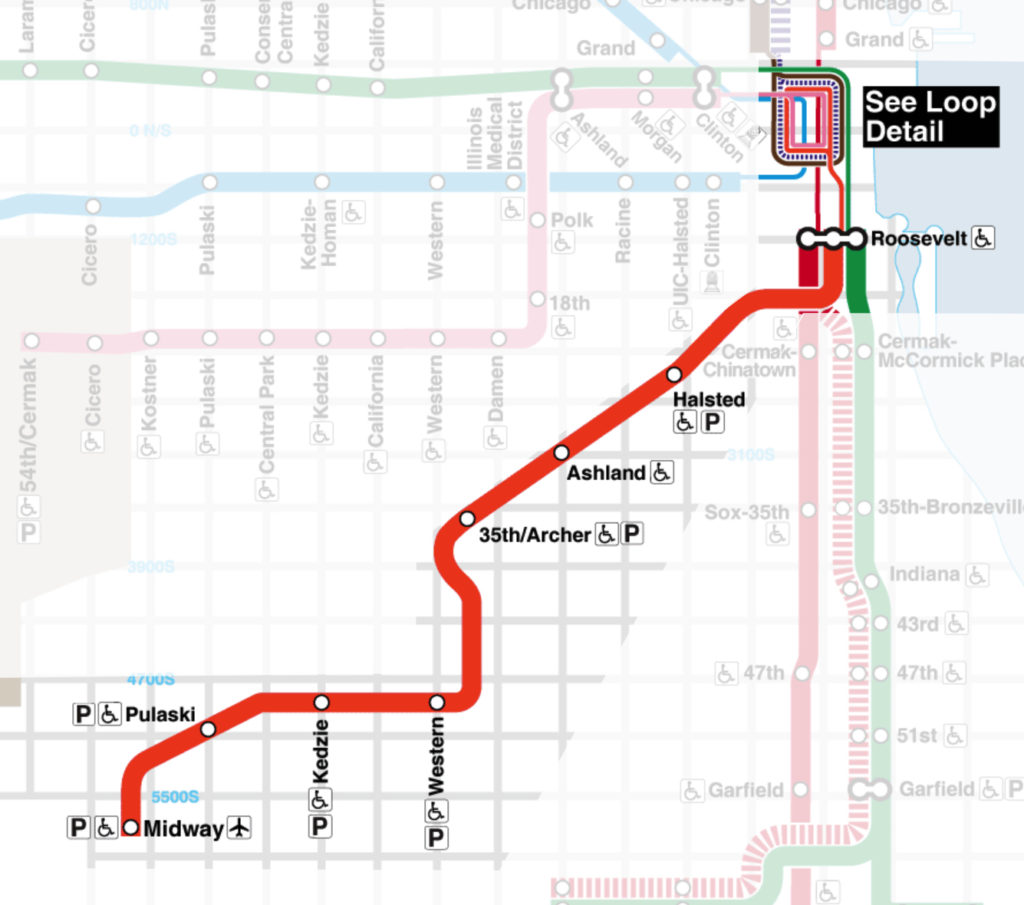
Most notably, the Orange Line is the line you would take to get to or from Midway International Airport, Chicago’s second most popular airport.
Between the Loop and Midway, the Orange Line makes only six stops, serving mostly residents of this part of the city.
The Purple Line
These last two lines are strange lines, so bear with me a bit. We’ll start with the Purple Line. There are basically two components to the Purple Line. First, it is an extension of the Red Line that runs from Howard (the northernmost Red Line stop) through Evanston (a suburb) and into Wilmette (another suburb).
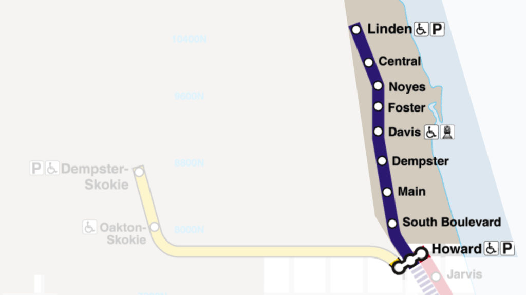
This extension most notably serves Northwestern University, but take it to the end (Linden), and you’ll be just a few blocks from the Bahá’í House of Worship, the oldest surviving Bahá’í temple in the world.

The second component of the Purple Line is a weekday rush period service. You can see the map of the rush period route above on the Red Line (north branch) and Brown Line maps.
This train runs its normal extension route between Howard and Linden (the Wilmette Stop), but it also makes the long journey from the Howard stop into the Loop, connecting Purple Line riders quickly with downtown.
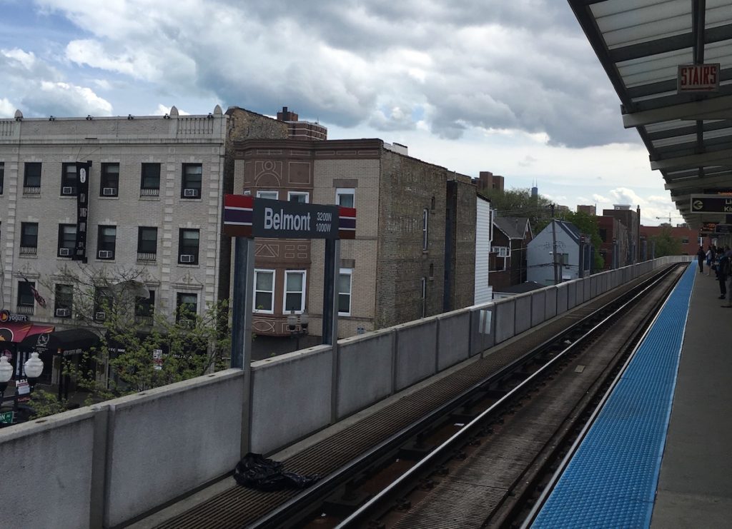
To get to the Loop, the Purple Line travels from Howard down the Red Line tracks making no stops until Belmont, at which point it joins the same track as the Brown Line, making the same stops as the Brown Line between Belmont and the Loop. Adding to the confusion, the Purple Line and Brown Line go opposite directions around the Loop.
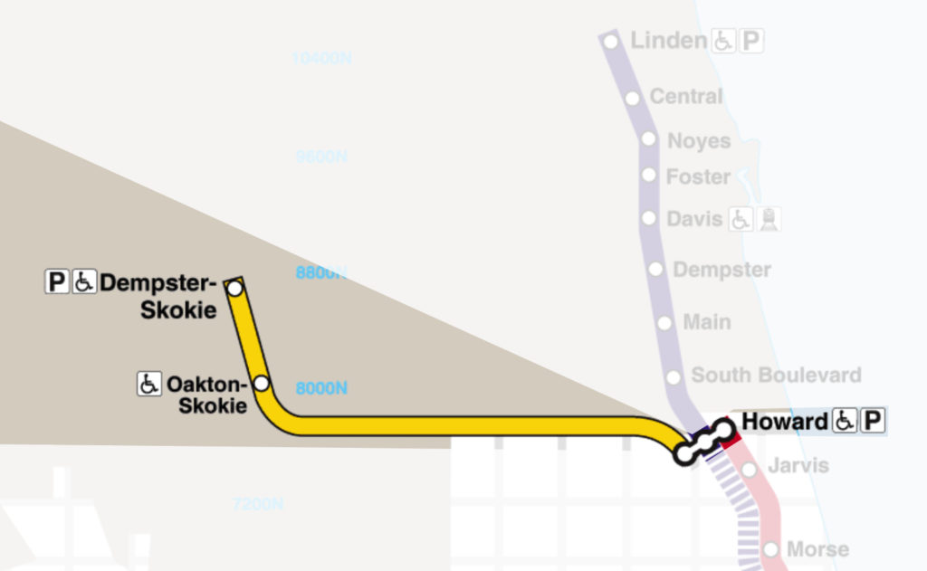
The Yellow Line
The Yellow Line is another extension of the Red Line, but without any sort of fancy rush hour component. The Yellow Line runs from Howard into Skokie (a suburb), making two Skokie stops at Dempster and Oakton.
Transfers on Chicago’s L
Sometimes one train won’t get you where you need to go, and you’ll need to transfer to a different line or to a bus. There are a few different transfers you can make when riding the Chicago L. We’re going to break these into transfers between L trains and transfers to/from L trains from/to other types of transit.
Transfers Between L Trains
The L is designed to allow for numerous free transfers between train lines, particularly in the Loop. Most are as simple as walking to the other side of a platform. However, some free transfers require you to leave one station and enter another one. In those cases, you need to make sure you have your original ticket / card / contactless payment method so that you can get into the second station.
Keep in mind that to take advantage of a free transfer between stations you need to go to the proper second station. In the Loop, stations can be separated by only a block or so–make sure you go to the correct one for a free transfer.
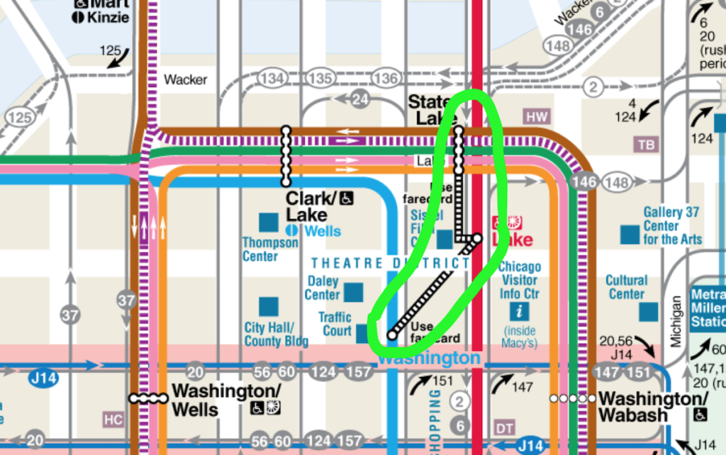
The CTA system map indicates free transfers that require a fare card with the dashed black and white lines circled above. Transfers not requiring a card are connected via a solid white line (as in all the stops at State/Lake, Clark/Lake, and Washington/Wells above).
You can also typically follow signs at the stations that indicate how to get to your free transfer:
There are also paid transfers. Any transfer that isn’t free is a paid transfer. A paid transfer costs 25 cents for up to two rides within two hours of starting your first ride.
Transfers to/from CTA and Pace Buses
While both CTA and Pace Buses take cash, you need to use another method (ticket, card, contactless payment) in order to transfer to or from the bus. You cannot purchase a disposable ticket or pass on a bus.
So if you only had $3 cash and you needed to take a bus and then transfer to a train, you’d need to go to a nearby train station and buy a disposable ticket for the bus. That ticket would allow you two transfers. Or you could use your cash for the bus and then use a bank card to pay full fare for the train.
There are no free transfers between two buses or between buses and trains (except that the 25 cent transfer fee includes a second free transfer).
Safety on The L
Safety is a big, and legitimate, concern for anyone riding public transit in any big city. And truthfully, I’m a little torn about how to handle it on this site.
The standard tourist pitch is “if it’s somewhere we’re telling you to go, you’ll be 100% safe going there.” That’s BS for two reasons. First, you’re not 100% safe from crime anywhere popular in a big city like Chicago. Every tourist destination in the world struggles with pickpockets, at a minimum.

Second, there are plenty of places worth going that are only “98% safe” to get to–whatever that means. We’re not going to ignore destinations based on some arbitrary standard of safety. So, let’s get back to talking about safety on the L.
So, are you safe on the L?
We happily take the L anywhere we need to get if the L services the area. Do I feel as safe at every train stop as I do in my own home? Or as I do on Michigan Avenue during the day? No. But my perceptions about safety just impact my behavior and situational awareness, not whether or not I would go somewhere I wanted to go.
Because most of us who have lived in the city for years are comfortable–sometimes to a fault–you’re likely to see trains filled with people who ignore every tip in this section. If you rode the Red Line end to end in designer clothes with your laptop out and holding your phone, it’s probably still not likely you’d be a victim of a crime, but the odds are much higher than if you didn’t do those things–so, you know, DON’T!
This is all to say there’s no right answer about safety. Statistics won’t help either. They don’t control for things like how busy a train line is, what hours the crimes occurred, what the motivation for the crime was. Pretty much, you can guarantee that everyone is at high risk for petty crime, like pickpocketing, and incredibly low risk for being a random victim of a violent crime between sunrise and sunset.
Tips for Staying Safe on the L
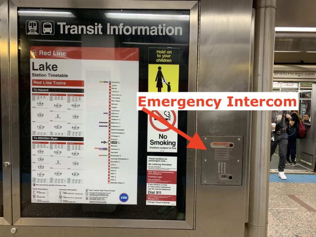
There are emergency intercoms on the platforms, but they’re often not very well-marked. And honestly I wouldn’t count on them in a real emergency.
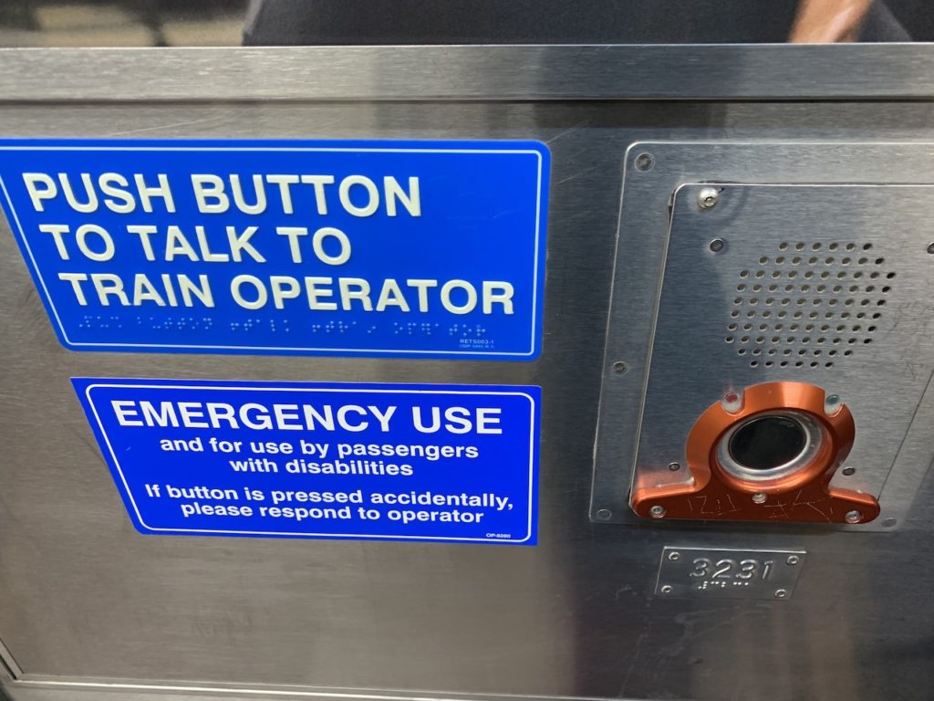
Each train car also has emergency intercoms that connect you to the conductor. Don’t think just pushing the button will bring the train to a halt and send help running your way. The conductor will usually come on and ask you to explain your emergency.
Look around most CTA stations and on trains and you’ll see tons of cameras. Don’t be comforted by those. There’s absolutely no reason to think these cameras are effective at deterring crime, and they may even increase it by luring commuters into feeling safer than they are.
You can get pickpocketed or strong arm robbed (that is, robbery without a weapon) absolutely anywhere in the city, and you should always be alert to that fact. When riding trains, keep your wallet in your front pocket and make sure you put away your phone as you approach any stop. Thieves like to snatch your device at a stop and exit the train before you process what happened.
When in doubt, sit in the front train car near the conductor. I’m not sure how much this actually matters, but when I’m on the train at dodgy hours, I try and put myself as close to the conductor as possible. This is the only car that has an actual person of authority in it who can quickly alert the police to any crime.
In case someone is bothering or harassing you, there are a few options. First, you can alert the driver via the emergency intercom.
Changing train cars (preferably to the front one) at the next stop is another option. Alternatively, during busy hours, you might exit the train and wait for the next one.
Unless you know your way around the stations, your best bet in off-hours will be to go to the front car and alert the conductor. Conductors (usually) do a visual inspection down the platform before they close the doors, so you should be able to get some attention. Don’t just exit onto a strange platform at night.
Non-Safety Issues on Chicago’s L
One non-safety issue worth mentioning here is the prevalence of untreated mental health problems in Chicago. While it isn’t quite as prevalent as New York City, you’ll often encounter strange behaviors, like yelling, on the L. This reasoning is a bit circular, but as long as the behavior is non-threatening you don’t need to concern yourself with it.
Another non-safety issue is people asking for money. People will pass through train cars asking for money, typically giving a speech that explains their need beforehand. These are usually not threatening people. That said, all things are on a spectrum. If you’re alone on a train at 4AM and someone approaches you with no warning and says “got any money?” you’re likely being threatened.
You may also encounter people selling cigarettes (“loose squares”), candy bars, or other small items.
I Want To Get To…
This is a quick reference for people who want to know what L stops are closest to major tourist destinations. We always recommend using Google Maps to navigate Chicago. Where we say “Other Lines,” we’re not including the Purple Line (outside of rush periods) or Yellow Line.
- Chinatown — Red Line Cermak-Chinatown
- Guaranteed Rate Field — Red Line Sox-35th or Green Line 35th Bronzeville IIT
- The Hancock Center — Red Line Chicago and walk 10 minutes east
- Lincoln Park (the neighborhood) — Red/Brown Line Fullerton or Brown Line Armitage
- Lincoln Park Zoo — Brown Line Sedgwick and walk 20 minutes
- Magnificent Mile North End — Red Line Chicago and walk 15 minutes east
- Magnificent Mile South End — Red Line Grand and walk 7 minutes east
- McCormick Place — Green Line Cermak-McCormick Place and walk 15 minutes east
- Midway International Airport (MDW) — Orange Line Midway
- Millennium Park — Red Line Lake or Blue Line Washington or Other Lines Adams & Wabash
- Museum Campus — Red / Orange / Green Line Roosevelt and walk 15 minutes east
- Navy Pier — Red Line Grand and walk 20 minutes east
- North Avenue Beach — Brown Line Sedgwick and walk 20 minutes ease
- O’Hare International Airport (ORD) — Blue Line O’Hare
- Pilsen — Pink Line 18th Street
- Soldier Field — Red / Green / Orange Line Roosevelt and walk 15 minutes east
- Theater District — Red Line Lake or Other Lines Clark & Lake
- Union Station — Blue Line Clinton and walk 5 minutes
- The United Center — Blue Line Illinois Medical District or Pink / Green Line Ashland
- Wicker Park — Blue Line Damen
- Willis Tower — Brown / Orange / Pink / Purple Line Quincy or any Loop stop and walk
- Wrigley Field — Red Line Addison or Brown Line Southport and walk 15 minutes
Marlene Goodman
Tuesday 5th of September 2023
The L can be overwhelmingly congested during rush hour. This article is fantastic and offers great tips, but again, rush hour is rough. If visiting the city, plan arrival & departures to avoid the crunch.
Emily
Thursday 7th of September 2023
Ah yes! Very good point! In my Loop office days, I often couldn't catch the first train that passed by and if I could, it was always crowded. Thanks!